

Cycling on Salar de Uyuni
June 8, 2018The road to sustainable cities
June 25, 2018Counting dead animals
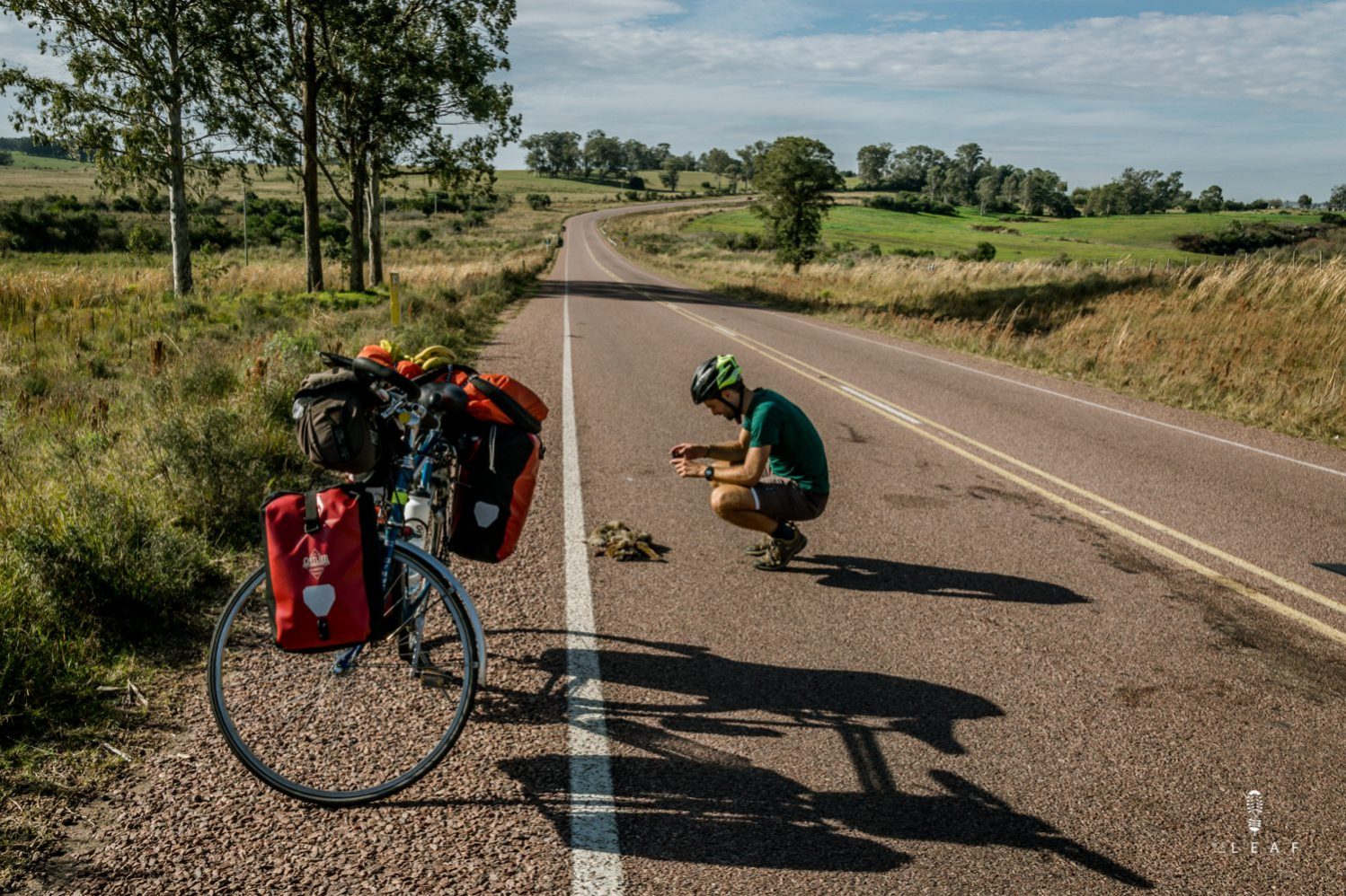
We stare into the distance when we see something black on the road. Is it a car tire, a wind-blown branch or a dead animal? It might be a little strange, but we are kicking the brakes when we see dead wild animals. We count, photograph and locate the victims.
Adventure Scientist maps the number of 'road kills’ with help of outdoor adventurers, ordinary citizens. By counting, photographing and locating dead animals, we contribute to scientific research. Scientists can extract important data from our data. They not only learn which animals are victims, but also which habitat species approach. Because of the large amount of data, 'hotspots' arise, places where animals are regularly hit by traffic. With this data governments can take action. For example by reducing speeds or building ecoducts.


Not only the researchers learn from the facts, we also become wiser. Normally we do not get off our bike when we see a corpse along the road. Nowadays we do. Contributing to this research makes us look at animals up close and learn more about them. We regularly see animals who’s existence we didn’t know. The app 'Naturalista' helps us to find the right names. We know which animals live in the habitat and learn to identify the living brother for wild watching. Without doubts, we are less proud of our developed ability to recognize the smell of dead meat from far.
We see a number of notable accidents along the way. Like in France where nature is rich in bird species, but we only find the Robin redbreast lost along the road. Time and time again, we count dozens of them. In Brazil we stop every half hour on a specific route to photograph a new protected barn owl, unfortunately dead. The fox seems to be the biggest victim of traffic. We have now marked more than a hundred of dead animals on our map. It are precisely the repetitions that make our hearts break. Therefore it is good to share our data with Adventure Scientist. Hoping that the threatened barn owl can be saved at the cause.
Of course, identifying and recording death animals is more an 'end-of-the-pipe solution'. Let's take the cause ourselves by watching our speed and avoid driving in nature protected areas by night.
Interested in helping Adventure Scientists as well? Check out their website and sign up for the Roadkill Project


5 Comments
Great information about wildlife presence and habitat. How do you mark the location of the dead animal? GPS? And do you record domestic animals as well?
Indeed, we use the GPS location the mark the location of the dead animal. The application we use for this automatically registers the location. Later we can see all our sightings on a map. The domestic animals we don’t record. There are simply to many street dogs that we find dead on the road, so we only register the ‘wild’ animals.
Your wild animal road-kill recording project sounds similar to what we have in southern Africa, and I plan to apply when I start my bikepacking trip soon. Is the application you refer to an App on your smartphone? If so, will you please send me the name.
Thanks WeLeaf, it is Awesome that you actively participate in collecting data to slow down or reverse degradation of the planet. Keep up the good work!
Yes, it’s an application on the smartphone. The name is ‘Naturalista’. The app isn’t from Adventure Scientists but they use this for the Roadkill Project. So in the app you can select the Roadkill Project and use this for our sightings.
Thank You! Will have a look